40˚ 46' 39.19" N
110˚ 22' 27.34" W

The Anaconda Opportunity.
An augustly trip through Utah, Wyoming & Montana
Thusly was the dealio,
Myself, Jonathan and Spencer spent two weeks hiking through some of the grandest locations in the world. We spent 3 days in the High Uintas Wilderness, 2 days in Grand Teton National Park in Wyoming, and then 6 days in Glacier National park, 5 nights of which would be spent in the backcountry. such walking. many altitude. Wow.
So first, as was the first place to where we went, we start in...
Utah
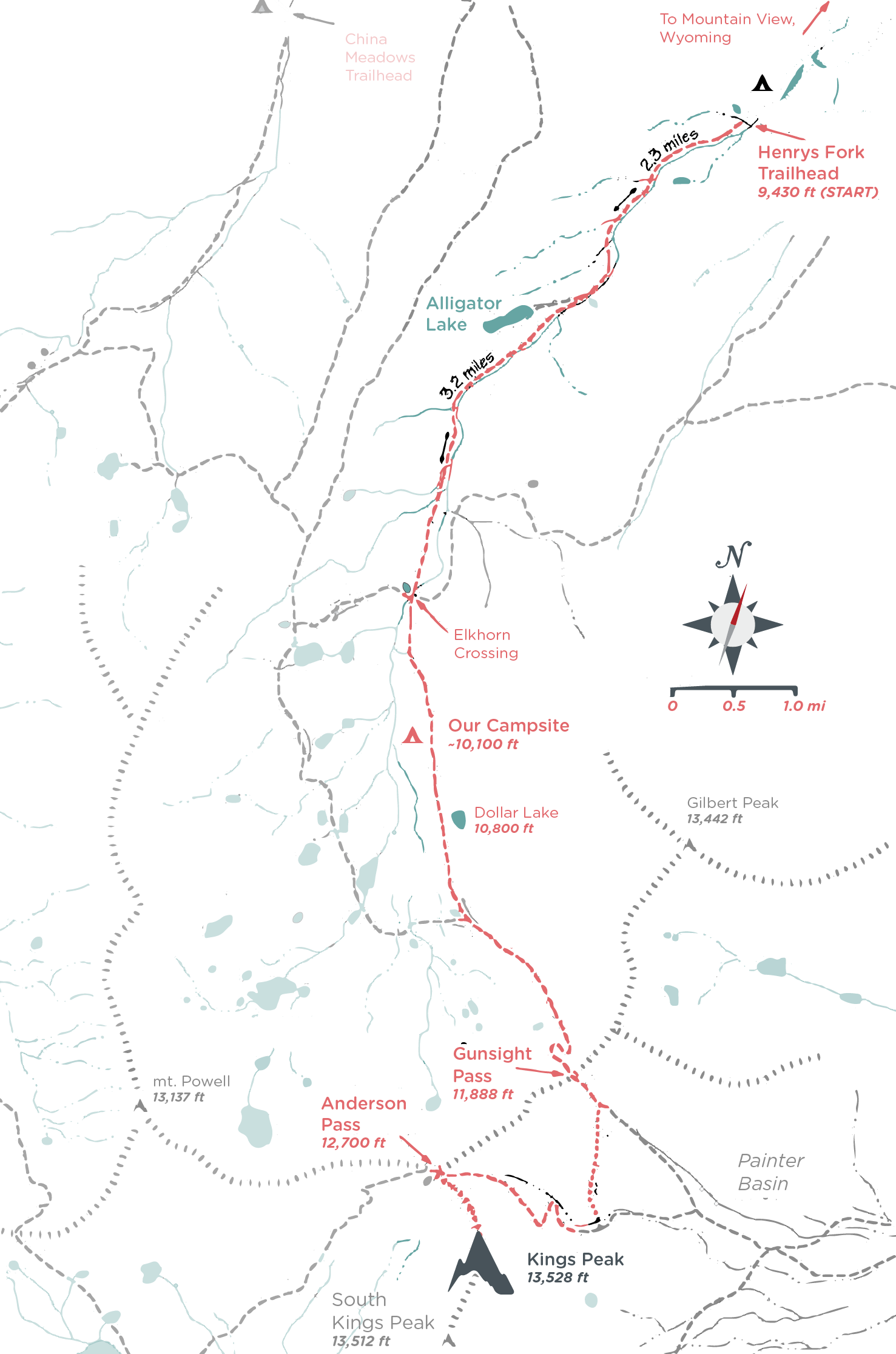
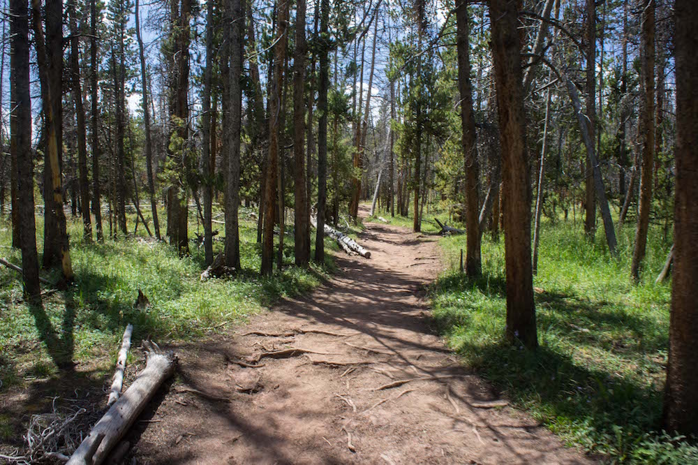
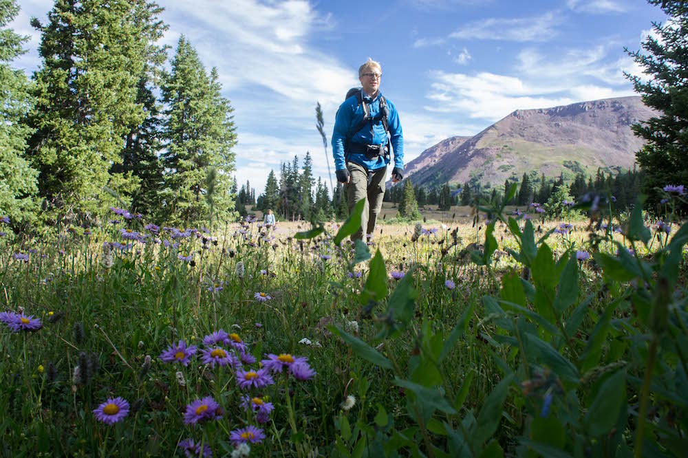
Our primary goal here was to climb Kings Peak. The general route for which you can see to the left. The route from Henry's Fork Trailhead consists of 30 miles, round trip, from 9440ft to 13,527ft; however, in contrast to previous summitings when I have done it 2 days or even once in 1 day (14hrs), we would take 3 days and 2 nights to adjust to altitude as well as take the requisite time to really enjoy this area.
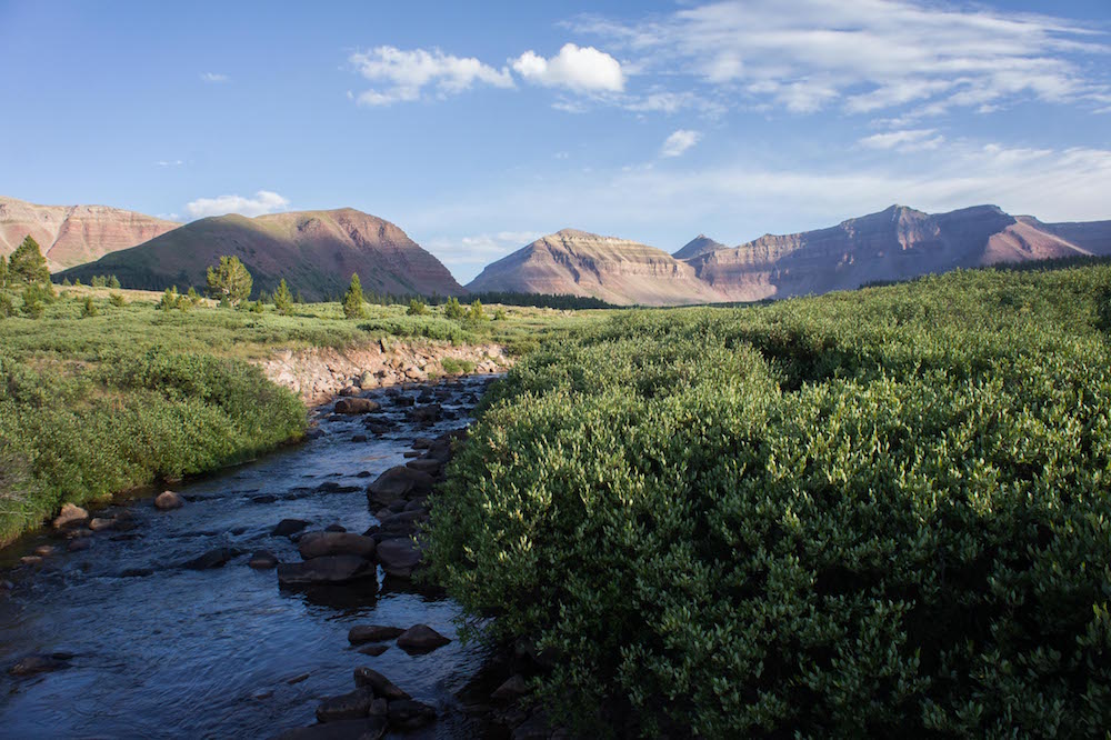
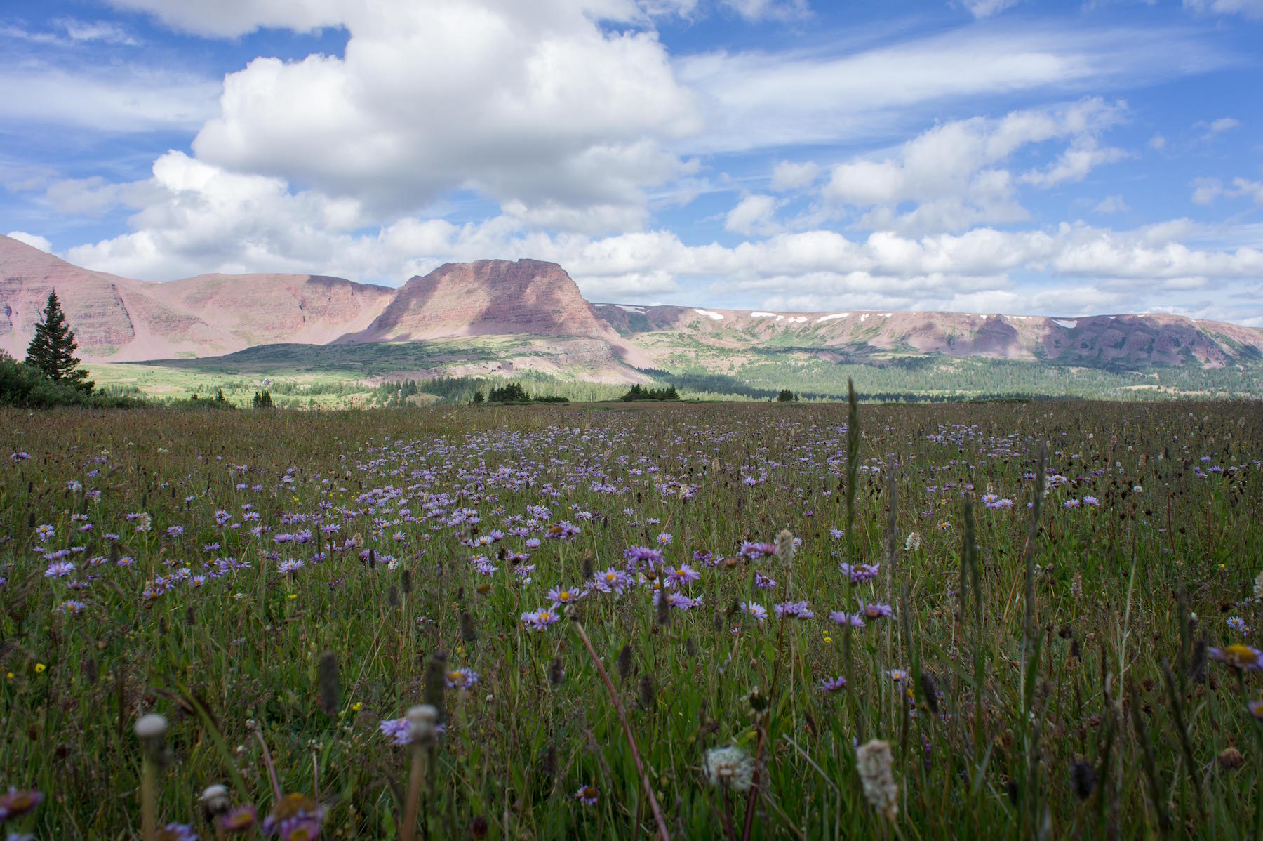
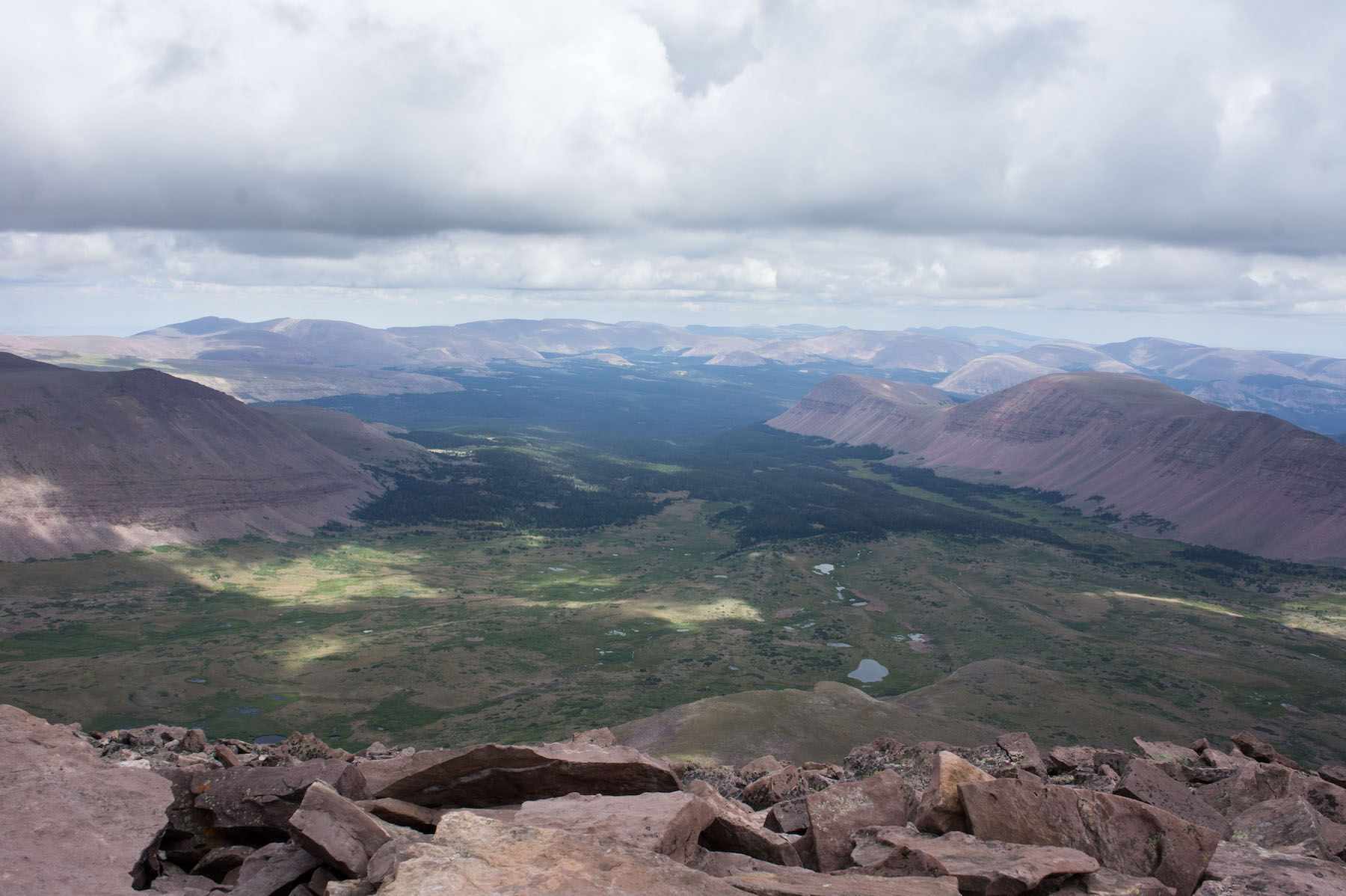
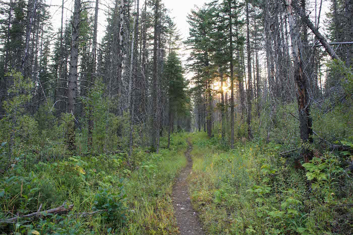
Making our way south, at about 8 miles in we arrived to where we'd set up camp and go for some water where, among the signs of sunset against the ridge, in the photo to the right you can see Kings Peak sticking up behind the middle of the ridge that is to the right of the gap.
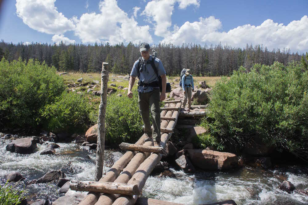
Day Two / eight miles in
Henry's Fork Basin - High Uintas Range, Utah / 40° 49' 55.59"N 110° 27' 19.48"W
We awoke, Jon constructed a fire over which we heated up some water for a quick breakfast of typical backcountry fare requiring re-un-dehydration(?), and we set off for the peak which was yet 7 miles away, yet whereas now we were at 10,700ft from 9,400 yesterday, it would prove to be more of a challenge than yesterday going the rest of the way up to 13,527.
Gunsight Pass / eleven miles in
With the increase in altitude, the air was getting thin. Gunsight pass is just under 12,000ft, and there are two options for getting to the peak. Traverse the ridge; requireing a fair bit of scrambling, some climbing, and good balance, or descending east into painter basin to then circle around and turn back west and ascend again arriving right at the foot of the peak. We opted for the decent into the basin this time, but we would take the ridge cutoff on the way back.
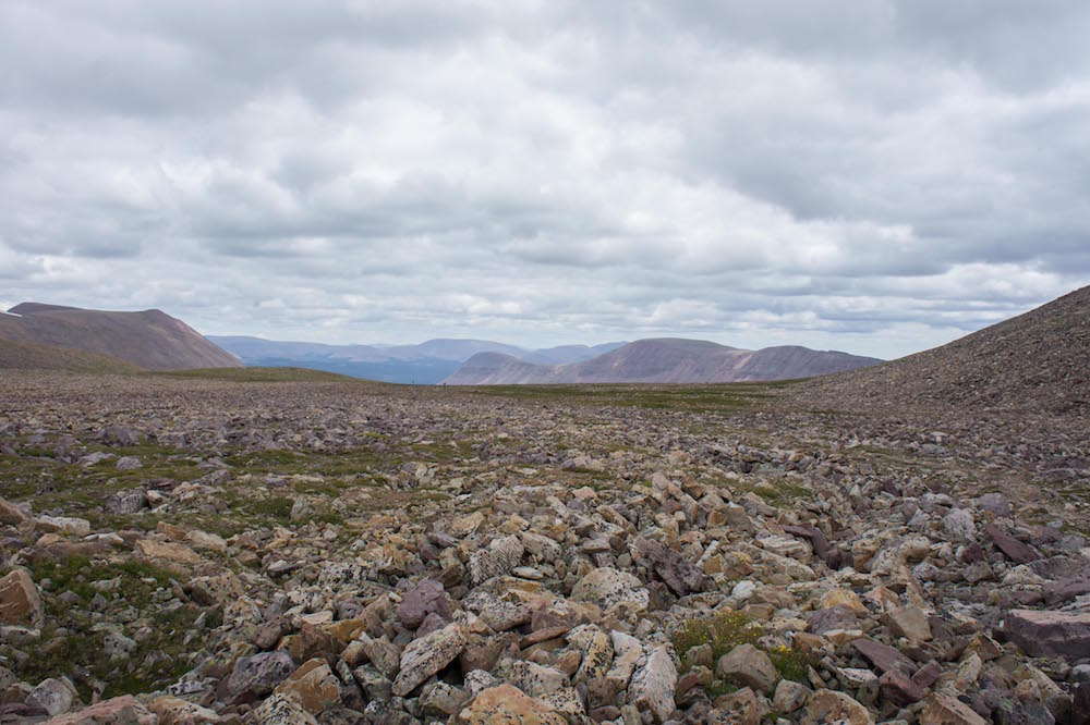
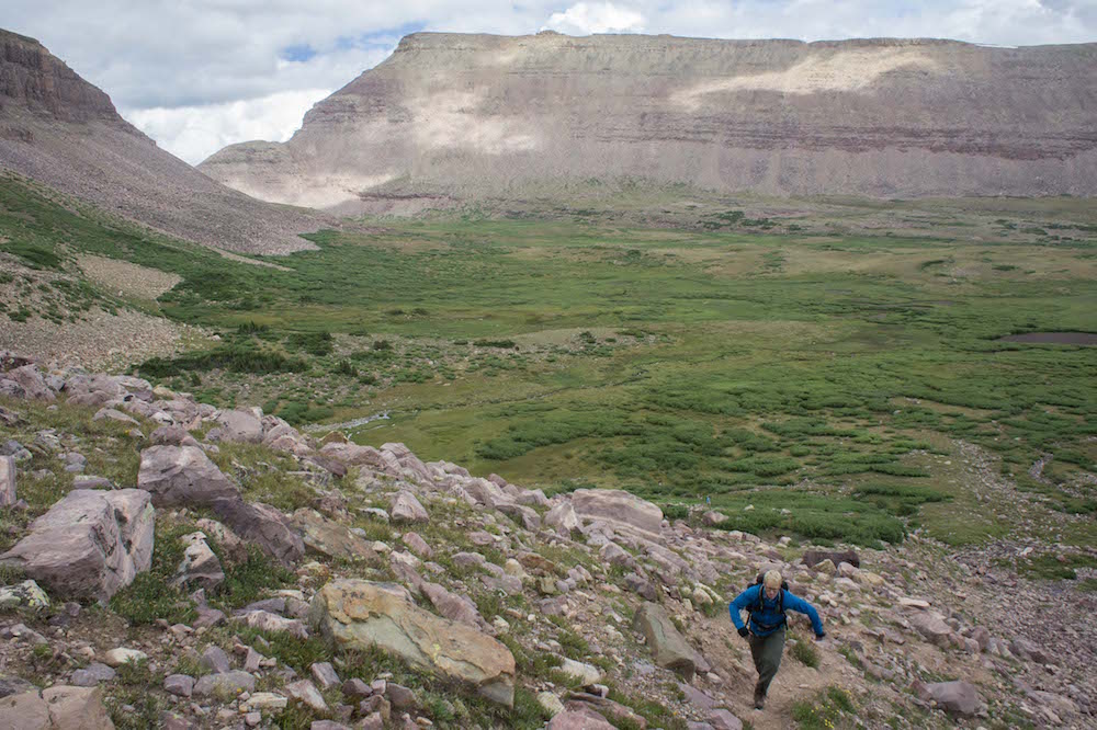
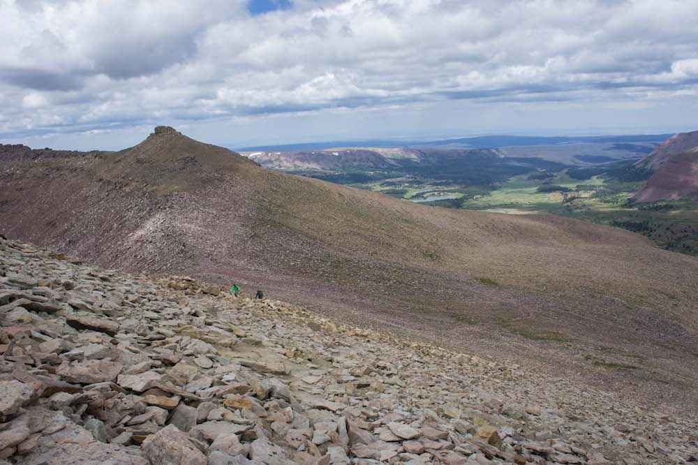
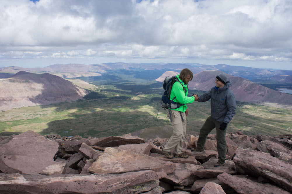
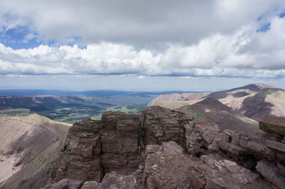
These photos start to show some of the scale of the place. Above, you can see two dots on the edge of the enormous rock field which makes the unaccomodating floor of the basin just at the foot of Kings Peak. To the right, Jon and Spencer are starting the climb up from Anderson pass (12,800ft). It takes just an additional 45-55 minutes to get from the pass to the peak.
Kings Peak Summit / 15 miles & 13,527'
40° 46' 39.19"N 110° 22' 27.34"W
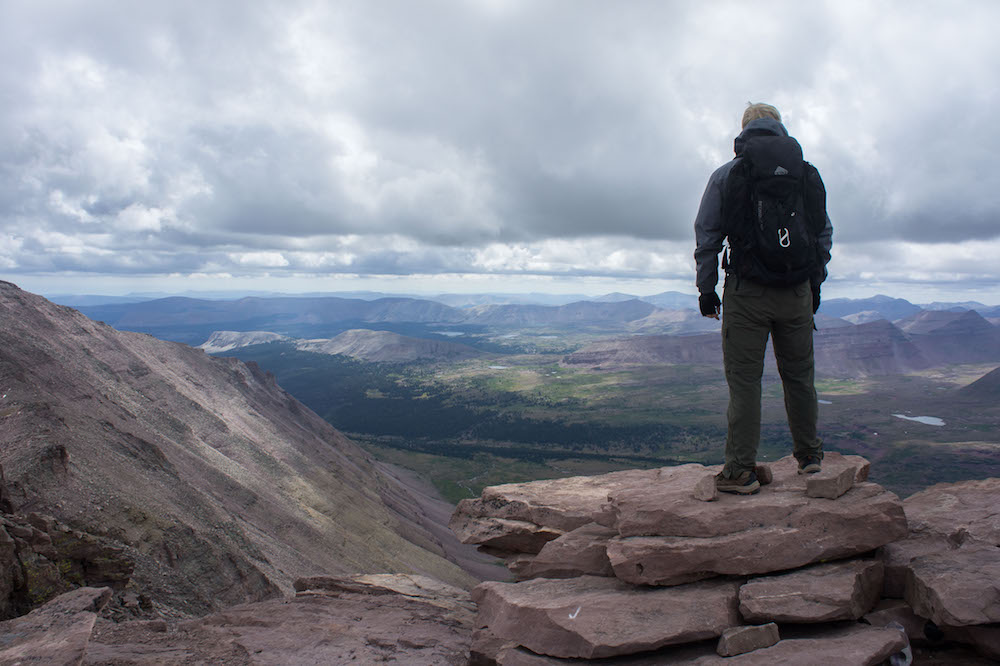
I'd made it to the summit before Jon and Spencer, and I had the peak to myself for about 30 minutes. I only attribute this to my having been aclimated; whereas, they of outstanding and better shape than I had come straight from the California coast and were still adjusting to the thin air.
Day 3 / Back to the car with 30 miles total
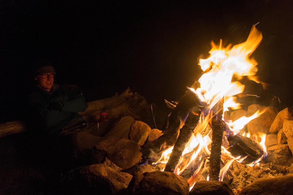
We got back to camp for one more night. Spencer had long since passed out, while Jon and I stayed up late by the fire eating food and talking into the night. In the morning, we would get up, hike the remaining 6 or 7 miles back to the car, load up again and head for our next stop..
Wyoming
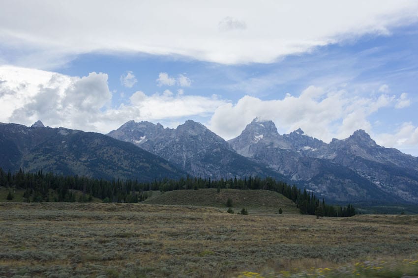
Grand Teton National Park
Driving north back into Wyoming from the Uintas range, we drove an additional 5 hours along Wyoming & U.S. Highways 89 which snakes the state and borders so took us from one state to the next. Out of Wyoming and back into Utah, Back into Wyoming, then into Idaho, then finally back into Wyoming as we got close to and eventually arrived in Jackson, Wyoming and Grand Teton National Park.
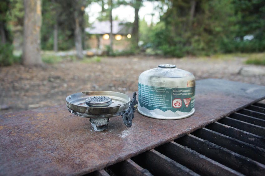
We had arrived in time to secure a campsite at Coulter Bay campground, and it wasn't too long until something happened.. something for which Spencer got his embarrasigly apt nickname "3-Alarm." He earned his new moniker by trying to cheat the system. Cheating the system of propane canisters and stoves, something of which the often quoted Hank Hill would greatly disapprove, yet such character's fictional existence rendered his wise words unheard as spencer lit a stove with another already lit stove. This caused the one he was holding to erupt into a maltov of impending doom, so he tossed it into the middle of the gravel street, and luckily it eventually burned itself out and was disposed of, but not before park law enforcement and fire crews arrived and Jon's and my faces had buried themselves firmly in our palms.
Paintbrush Divide Loop / 19 miles & 6,400 - 10,700'
40° 46' 39.19"N 110° 22' 27.34"W
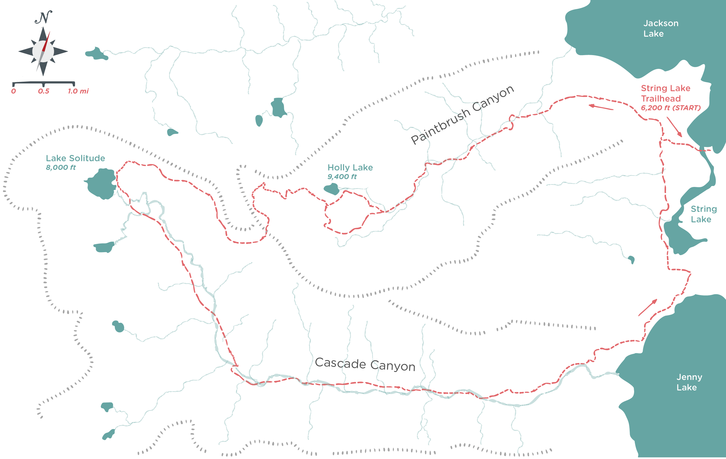
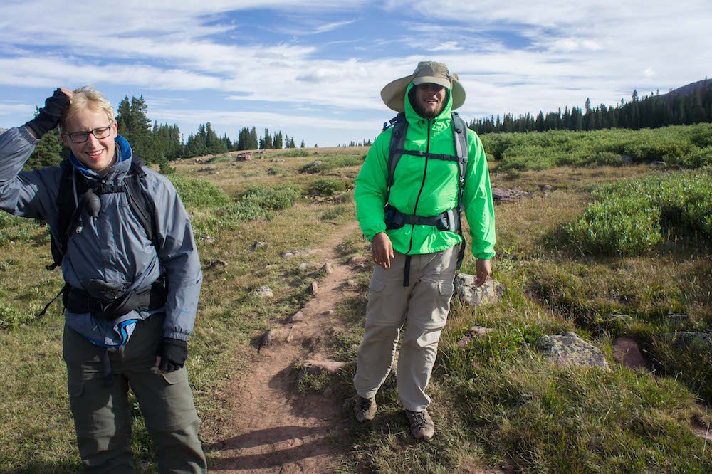
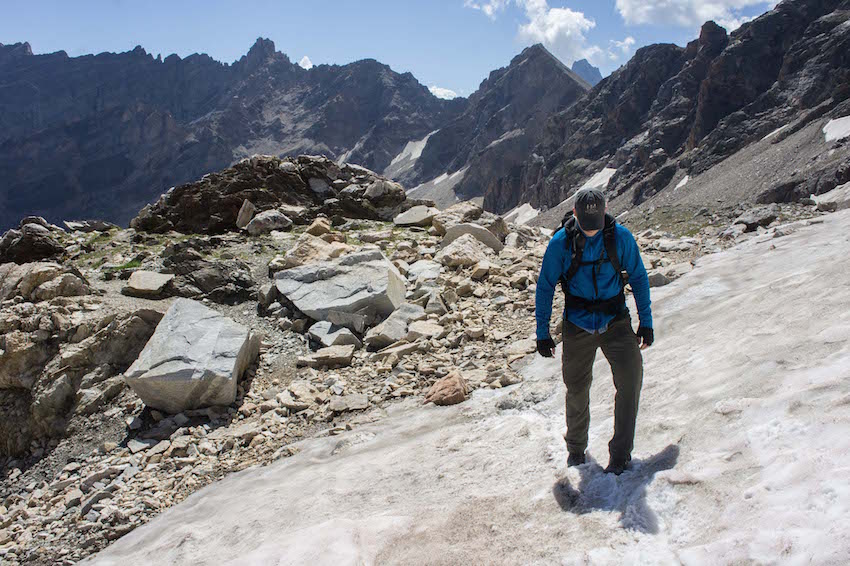
With yesterday's fiasco behind us, Spencer decided to rest up some more from Kings Peak and spend the day with the flat landers to get some important things squared away for uni coming up. So Jon and I took off for an 8 or so hour hike into the realm of the craggly peaks, flowing streams, likely snow field traverses, probable moose and possible bear.
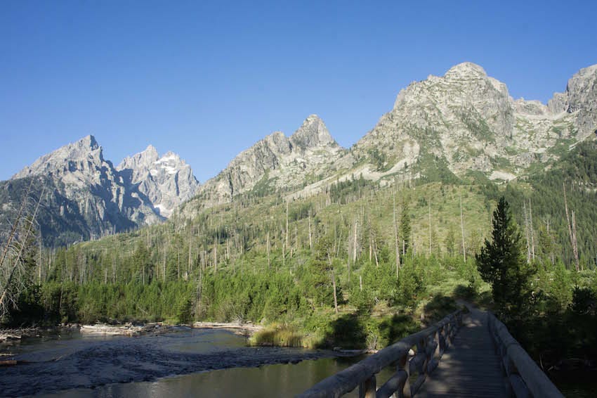
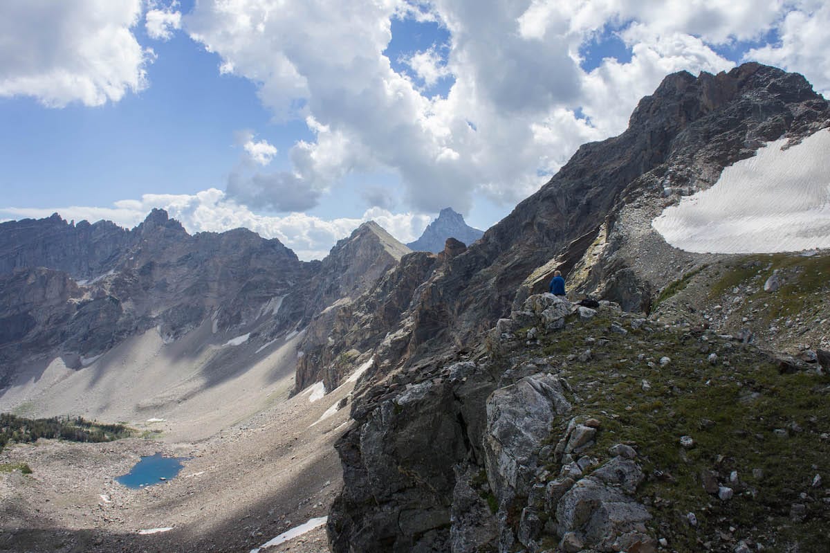
Into Cascade Canyon / 8 miles & 10,700'
40° 46' 39.19"N 110° 22' 27.34"W
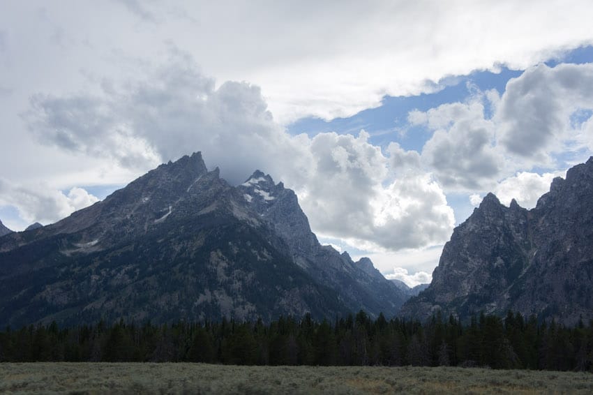
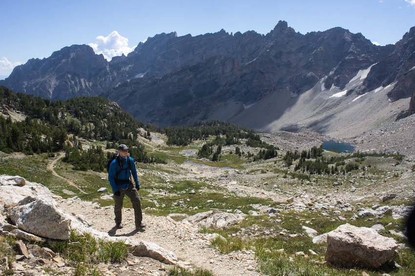
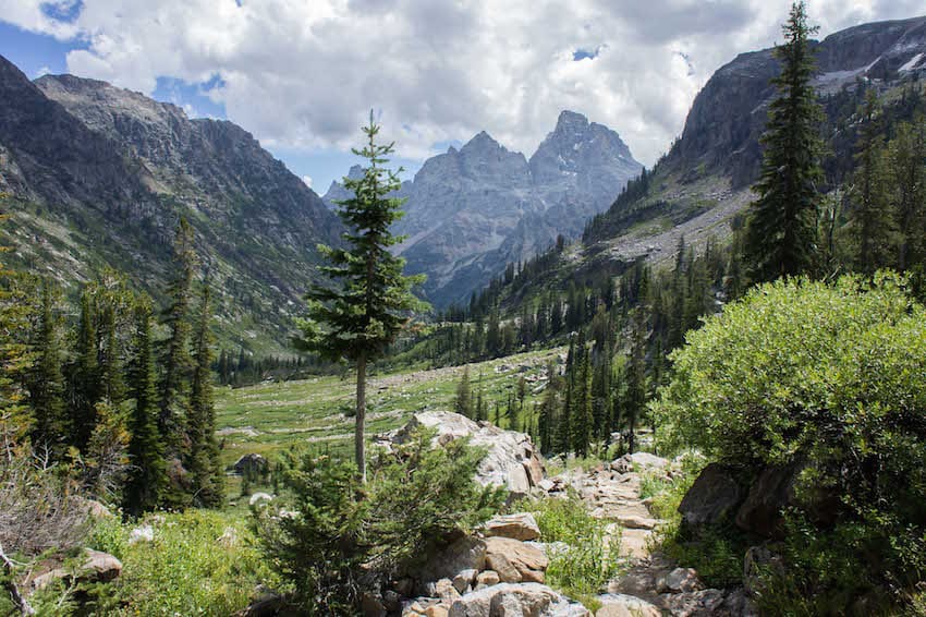
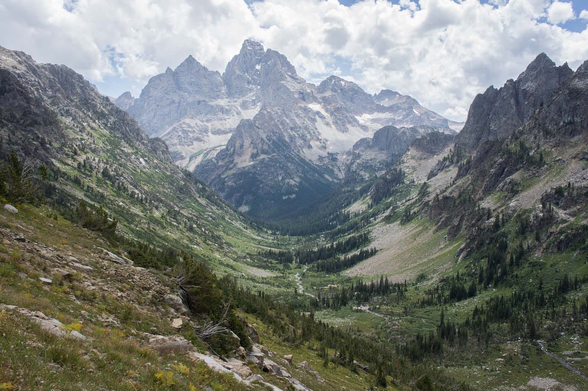
We made our way up Paintbrush Canyon and were now cresting over into Cascade Canyon which to me, holds the best views on earth.
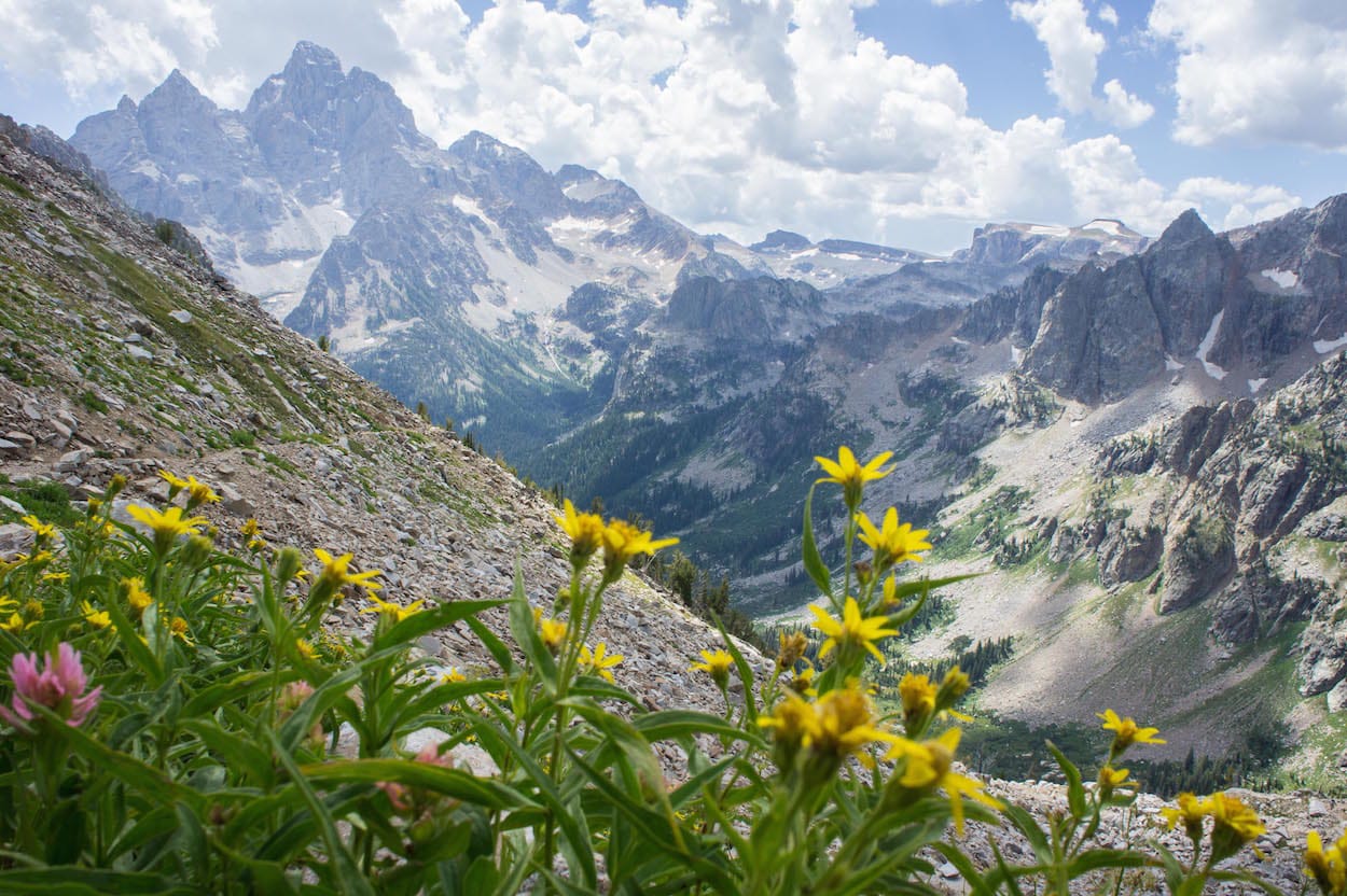
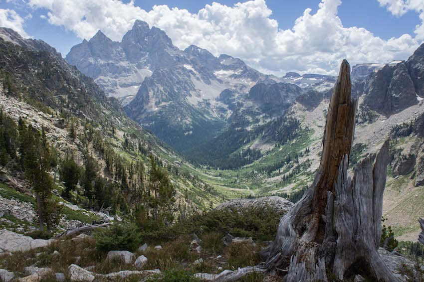
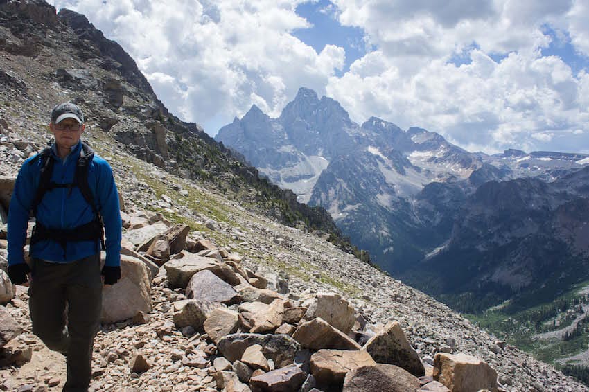
As we went along, the views got better and better. Jon gave the camera his best "Not bad.." face he could muster.
Montana
Glacier National Park
Okay so still in Wyoming, but we drove up through Yellowstone national park and exited Wyoming into Montana in West Yellowstone, MT. We thence made haste, taking advantage of the, absolutely obeyed, speed suggestions in Montana. After a few hours of driving, we arrived in West Glacier and entered the park.
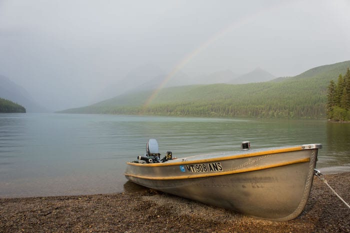
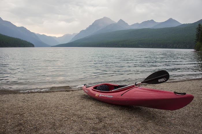
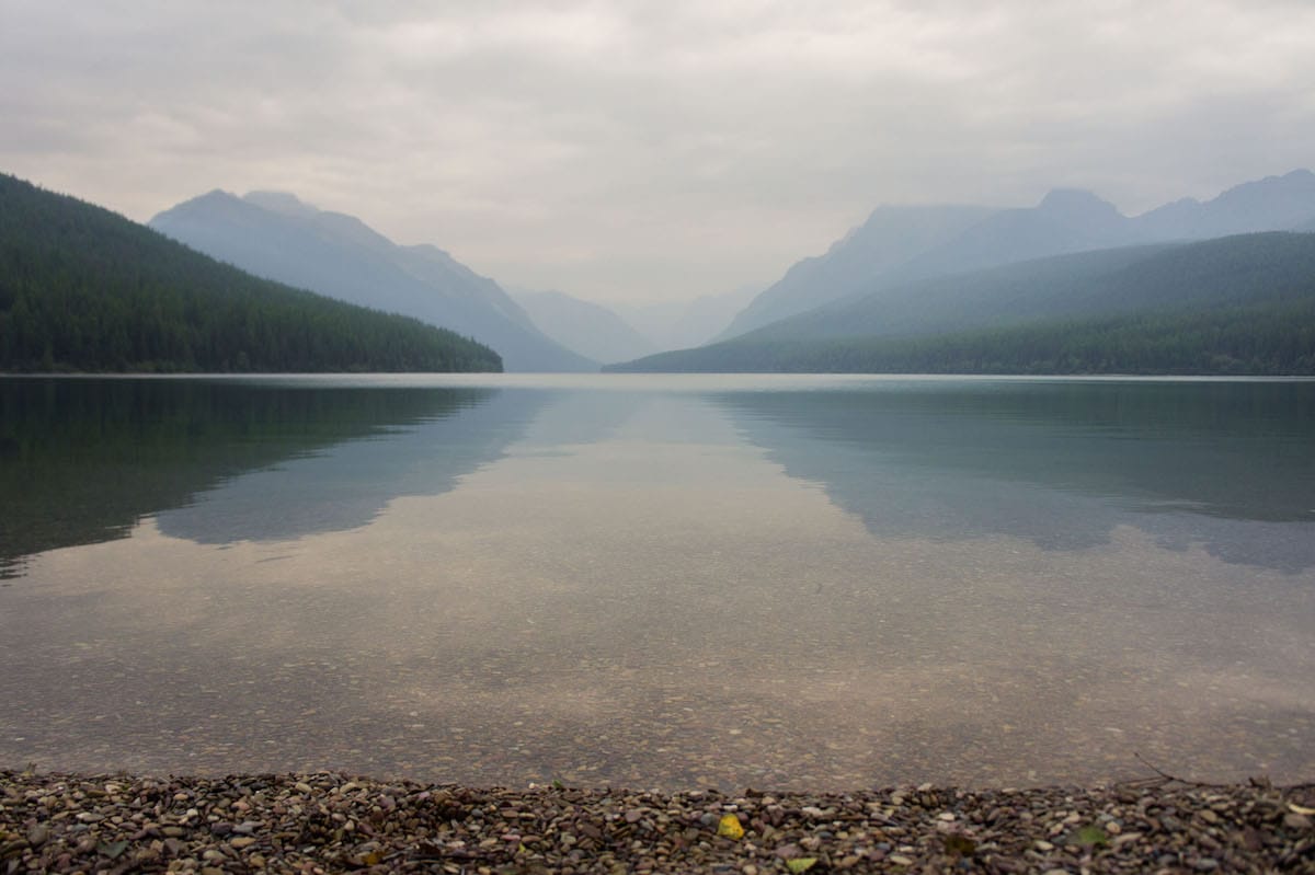
We spent the first couple days at Bowman Lake before heading out the second afternoon into the backcountry of GNP. The impact of the smoke was apparent and every so often we would hear rumors of new fires starting up here and there.
5 nights in The Glacier Backcountry / 70 miles total
40° 46' 39.19"N 110° 22' 27.34"W
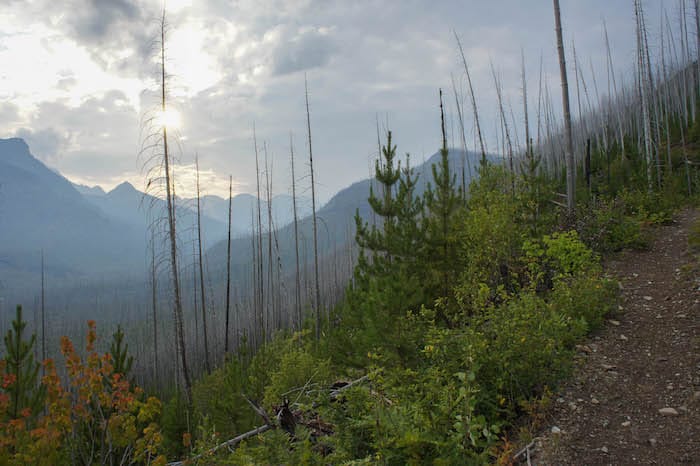
Backcountry pass in hand, err. rather zip tied to my backpack, we set off into the smoky wilderness. We had a hard time coming up with an itinerary at the ranger station, as much of the park was closed due to active, yet uncontrolled fires in the area. We did manage to piece one together; however, each day was consistently packed with high milage and altitude change. Due to this, the ranger had marked our permit with "itinerary not recommended."
Days 2 & 3
40° 46' 39.19"N 110° 22' 27.34"W
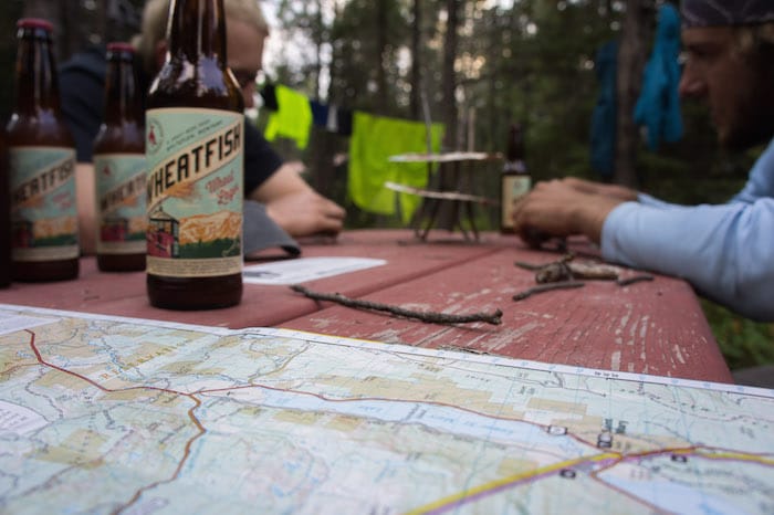
The above photo of epic 3D tic-tac-toe and beers betrays the sense of contiguous nights spent in the backcountry proper for the whole 6 days, as part of what it took to make the itinerary work with the craze of demand for backcountry camp areas was to utilize a night in Many Glacier Campground's backcountry only spots. This was to be the second night, and we would then head out again for the 4 remaining days in the backcountry.
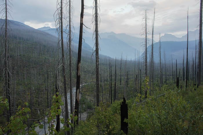
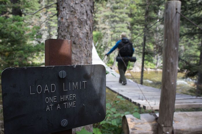
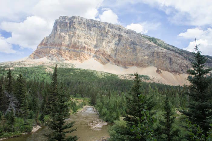
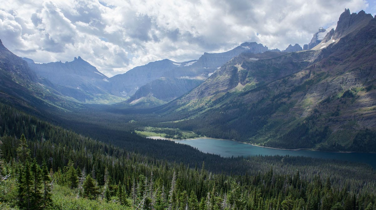
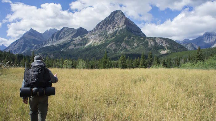
We made our way from Many Glacier 14.5 miles north to Gable Creek by means of the Ptermagen pass tunnel. The smoke had almost miraculously cleared the night before, and the views were excelent and clear this day and for the the next two.
Day 4
40° 46' 39.19"N 110° 22' 27.34"W
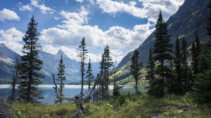
We spent the night in Gable Creek, and the next day we would actually do a bit of backtracking to get to Helen Lake campground, but it was worth it. We stopped at Lake Elisabeth along the way for some rock skipping and hanging out to rest up. I pulled out my fishing gear and set out for an hour or so of fishing, as it's currently free and doesn't require a state license in Glacier Park.
I managed to get 4 fish caught among plenty of nibbles. One of which in particular was a considerably fatty rainbow trout, which I managed to reel in on 3lb test with a bumb clutch in the reel causing it to not be able to hold. Thus it was a valiant battle, yet of course without having brought my trusty camera with which to document my galavant along the lakeside, I thus lack photographic evidence of this, and like so many before, this story will go down in the annals of guys' big fish tall tales as simply yet another.
Days 5 & 6
40° 46' 39.19"N 110° 22' 27.34"W
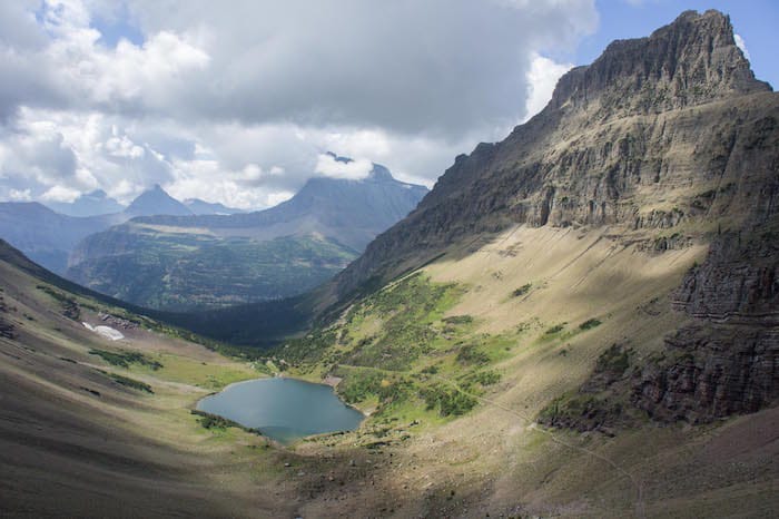
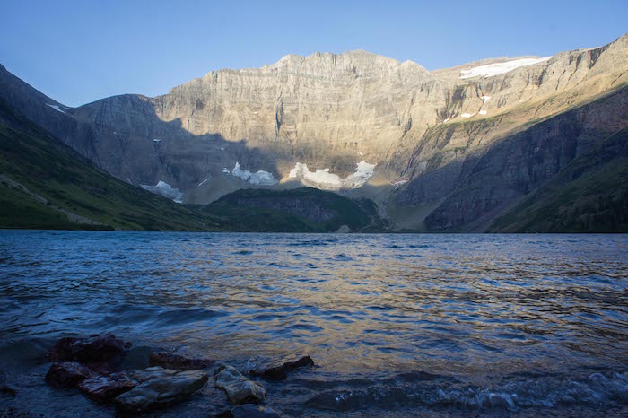
The night at Helen lake proved windy with the howling gales audible through the night as they screeched over the cirque which holds Helen lake. My battery having been exhausted trying to pull off long exposures of an unobscured milky way in a moonless sky, I was not able to take additional photos. But from here, we would hike another 15 miles to Poia lake, and then yet another 8 miles back to the car in the morning with the smoke back in full force. Walking out, we could even feel the heat of fires brought up the draw by the changing wind.
We drove back to Salt Lake City, completely obedient of the posted yet legendarily unenforced speed limits through the Montana native reservation land. We spent a couple days in SLC, and then caravaned back to California. Thus ended the Anaconda Opportunity, the namesake of two towns on the same road sign in Montana. Two weeks shared among close buddies in the wildernesses of Utah, Wyoming and Montana; many walking; so altitude; such wow.